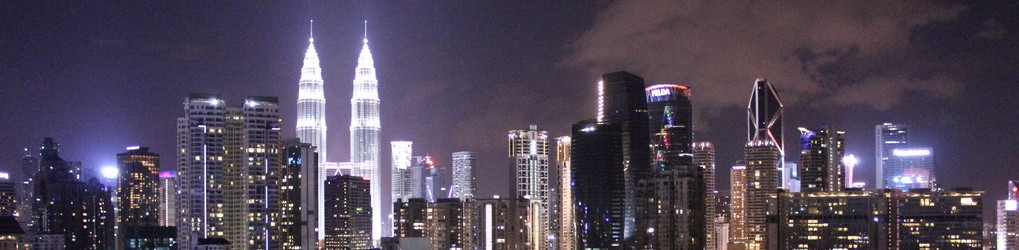
English version below ↓. Na een periode van drie maanden in Kuala Lumpur en met een vernieuwde stempel in m’n paspoort, leek het mij leuk om Borneo nog “even” mee te pakken, voordat ik door zou reizen naar het volgende land. Het idee was om nog wat prachtige eilanden mee te pakken aan de oostkust of Borneo, maar aangezien daar dreiging was van piraten, gevlogen op Kota Kinabalu, een stadje aan de westkust in Sabah, Borneo. De stad bezocht en een dagje gewerkt in Chilli Vanilla Cafe, waar ik voorzien werd van prima koffie, stroom en redelijke WiFi. Later doorgereisd naar Kundasang, een dorpje aan de voet van de berg Mount Kinabalu…
Ik verbleef in een dorm room in D’Villa Lodge voor weinig met uitzicht op een dal met prima WiFi en genoeg tafels en stoelen zowel binnen als buiten. Dit was handig, want in de bergen werd het al snel frisjes na zonsondergang. Hoewel dit hostel aan de voet van de berg lag, had ik er nog niet aan gedacht om de berg zelf te beklimmen. Al m’n warme kleding lag nog in Kuala Lumpur en ik had alleen m’n korte broek, een paar t-shirts en m’n wandelschoenen mee. Na met meerdere mensen gesproken te hebben – en ook met een gepensioneerde gids genaamd Hock – heb ik eind van de middag de knoop doorgehakt; ik wilde de berg beklimmen. Men vertelde dat het meer een hike was dan echt beklimmen en dat er geen touwen of andere zaken benodigd waren. Dit klopte ook, maar het bleek de zwaarste hike te worden die ik ooit heb gedaan.
Reserveren kan niet per telefoon, maar je kunt wel informeren of er plekken over zijn. Er zijn namelijk soms plekken over in de (verplichte) lodge op de berg, die ze graag alsnog op het laatste moment verkopen. Een alternatief is informeren of er cancellations zijn door de locals en voor de helft van de prijs gaan. Echter weet je dit alleen zeker de dag van te voren tot op de dag zelf 10:30, dus elk uur bellen en/of ‘s ochtends hopen op het beste zijn de twee opties voor die mogelijkheid.
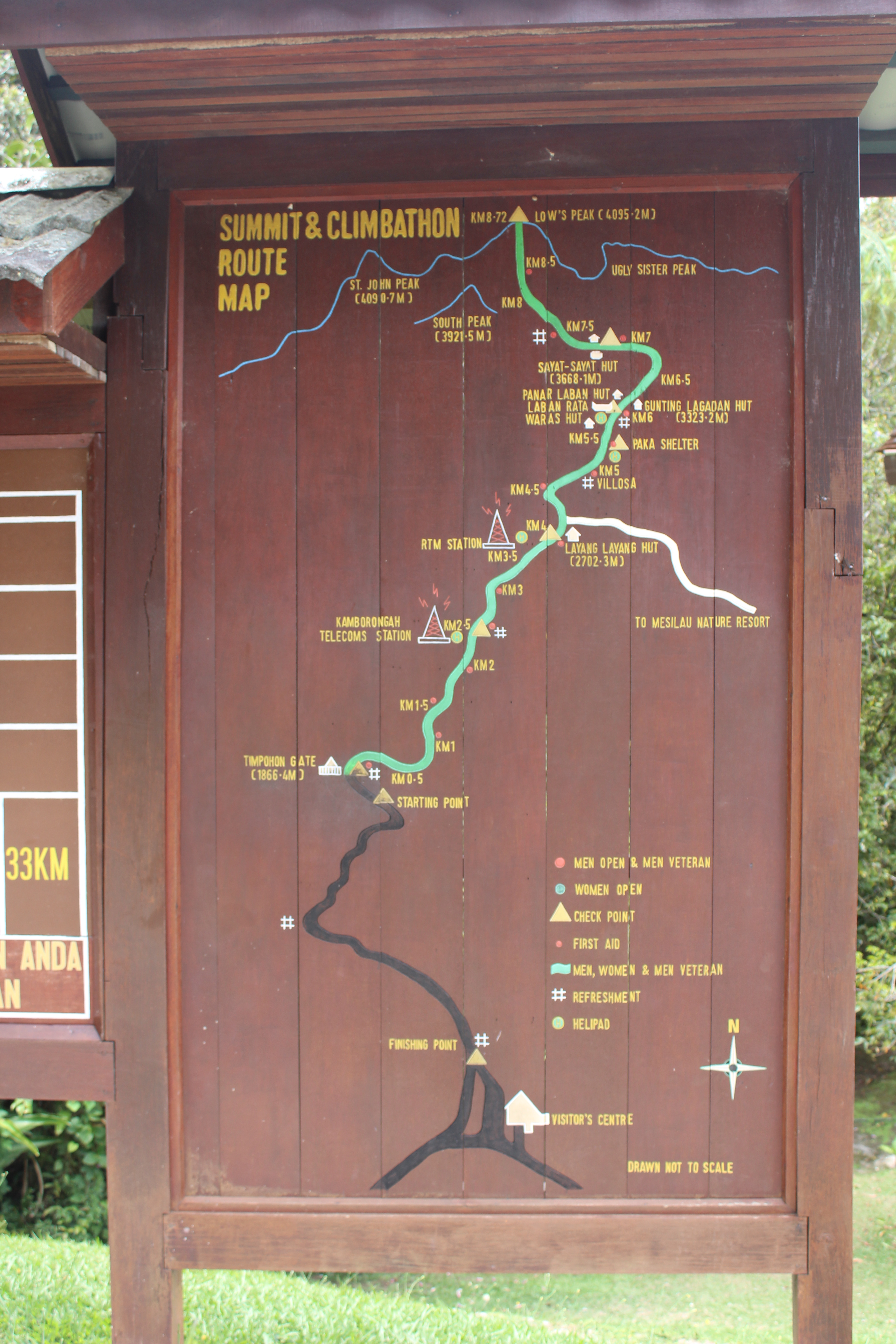
Map of the trail
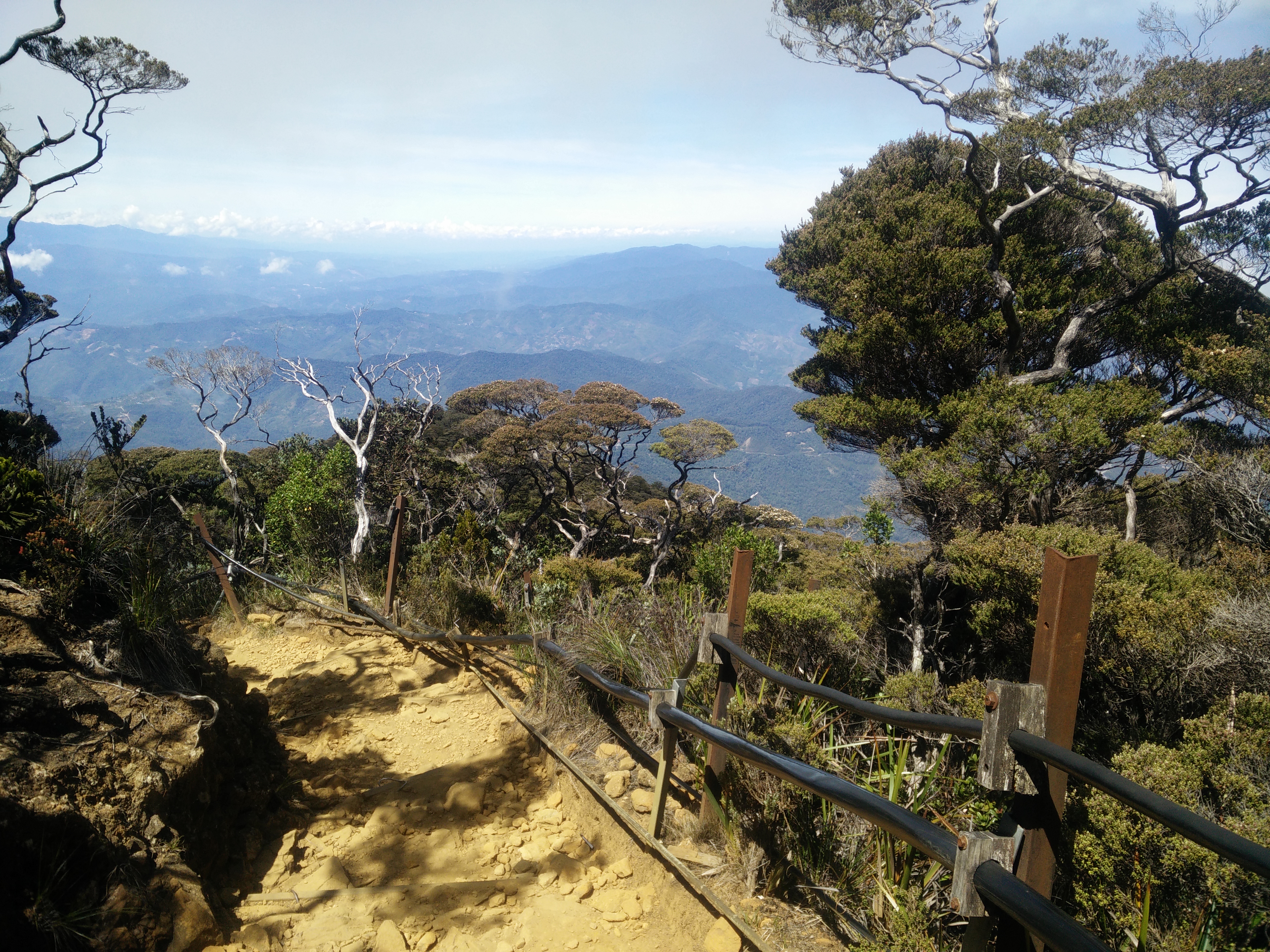
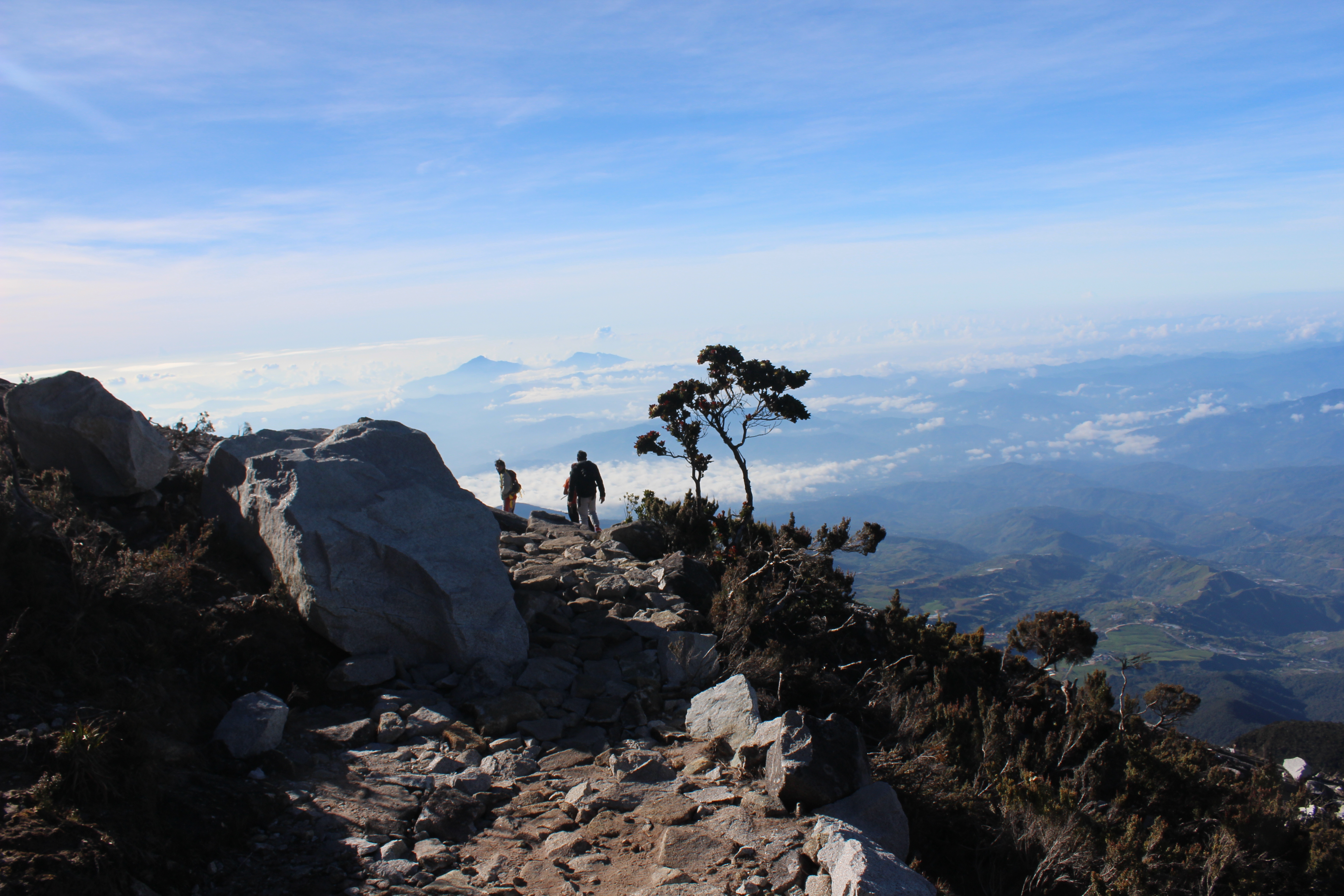
We verzamelden ‘s ochtends bij de ingang van Kinabalu Park voor het Information Centre. Vanaf hier werden we met een busje vervoerd naar de gate, waar officieel de klim begint. Tijd: 10:30. Elke halve kilometer staat een bordje met de afstand, wat zowel motiverend als demotiverend kan werken. Later zul je begrijpen waarom. Er wordt geadviseerd om aan het begin 1km per uur te doen, maar ik was met twee sportieve Engelse dames die wel van doorlopen hielden en we hadden 4km in anderhalf uur gedaan. Vanaf hier werd het zwaarder, want de spieren zijn op dit punt al enigszins aan het verzuren van het continue klimmen. De lodge is op 6km, dus de bordjes gaan je vanaf dit moment tegen staan. Tijd: 12:00.
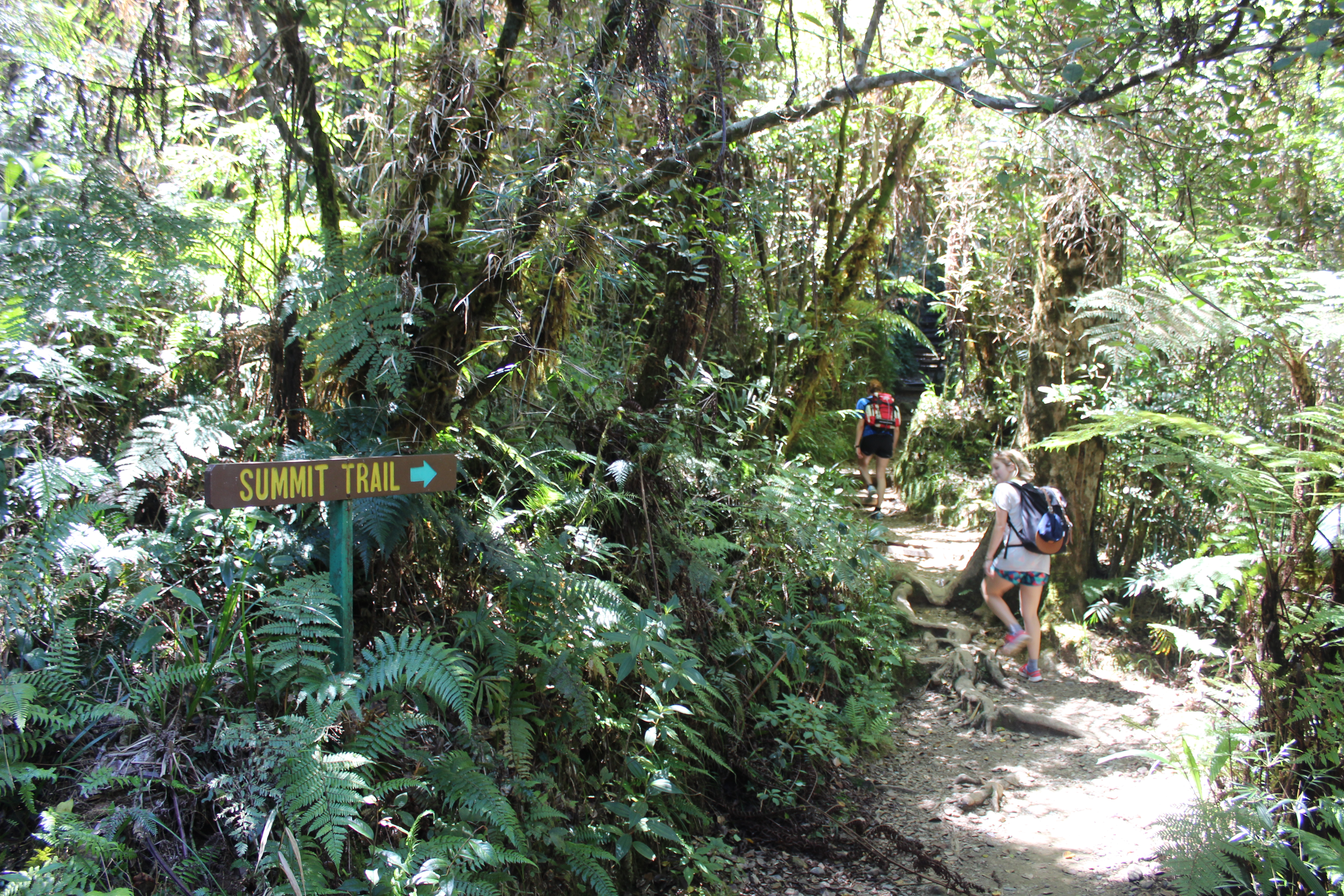
Start with sign to the summit
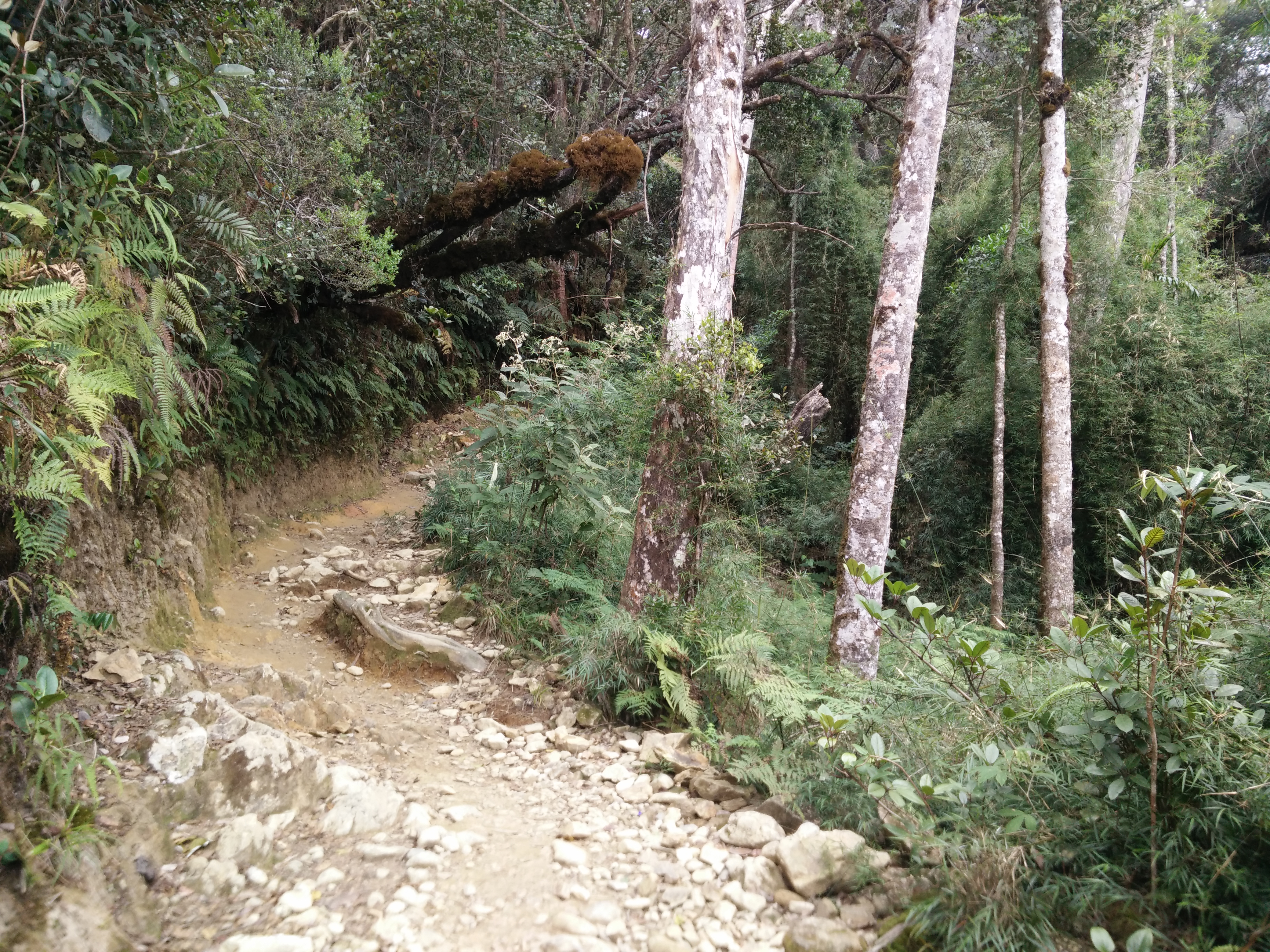
Part of the beginning of the path

Rock path going up
View back down from our way up
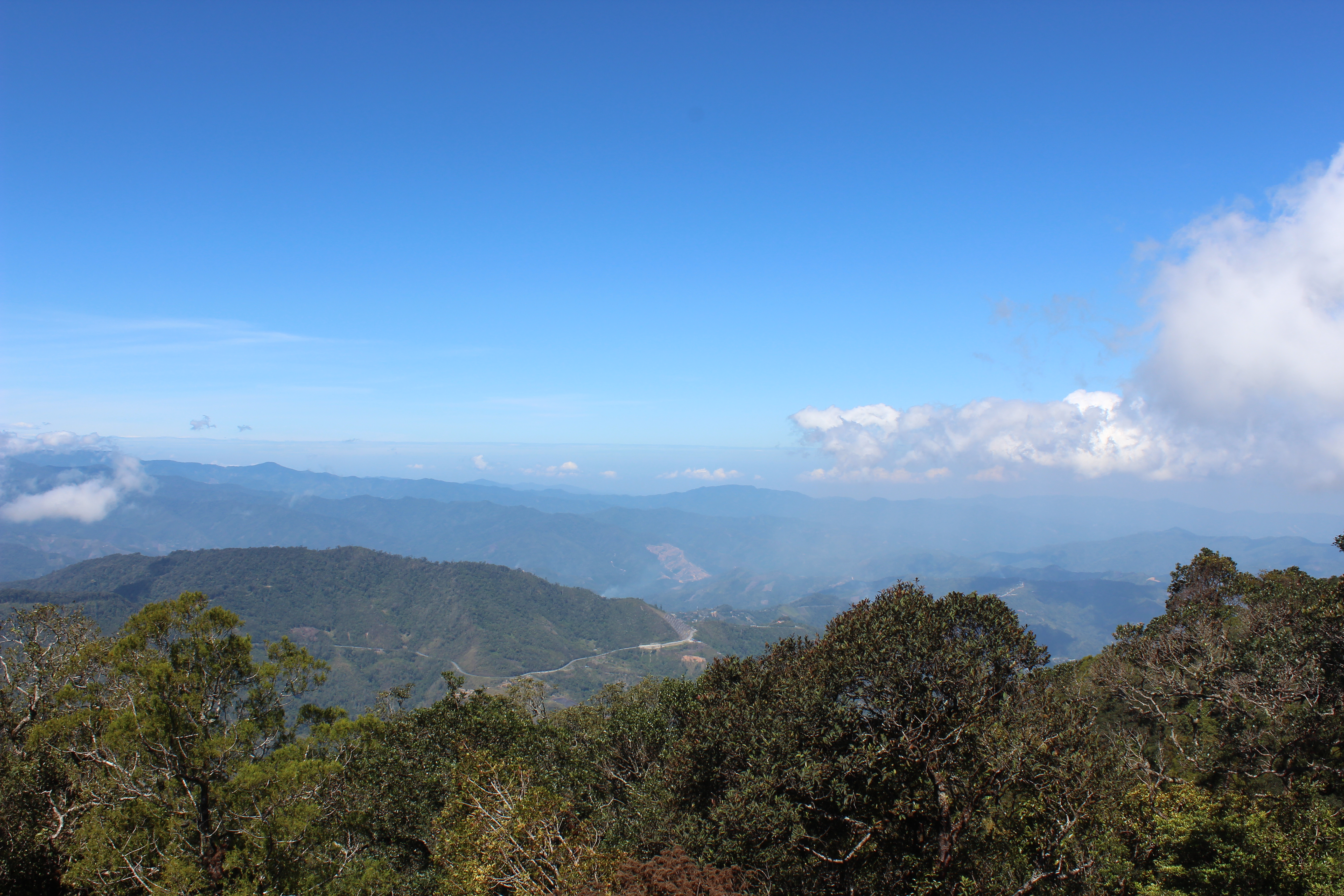
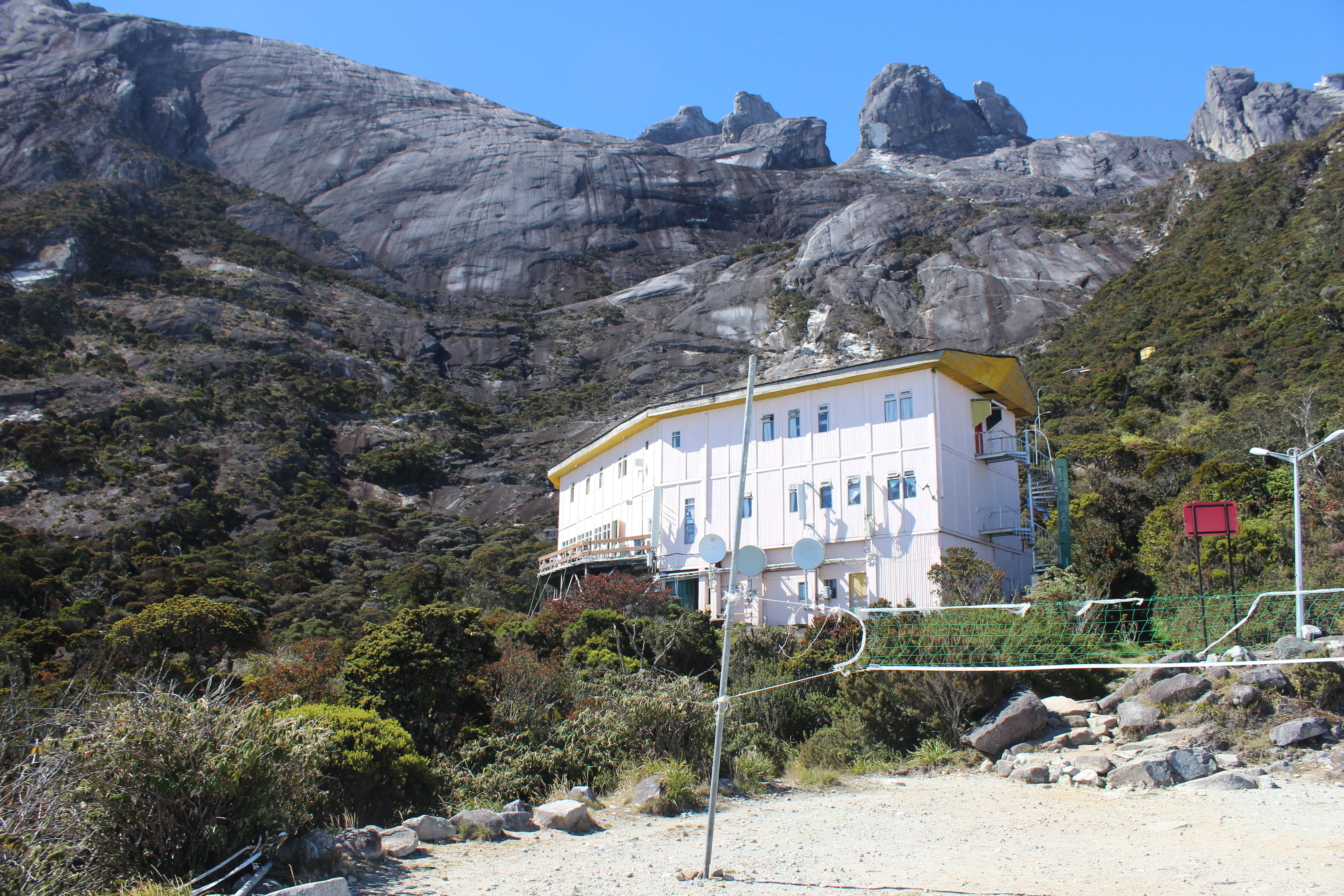
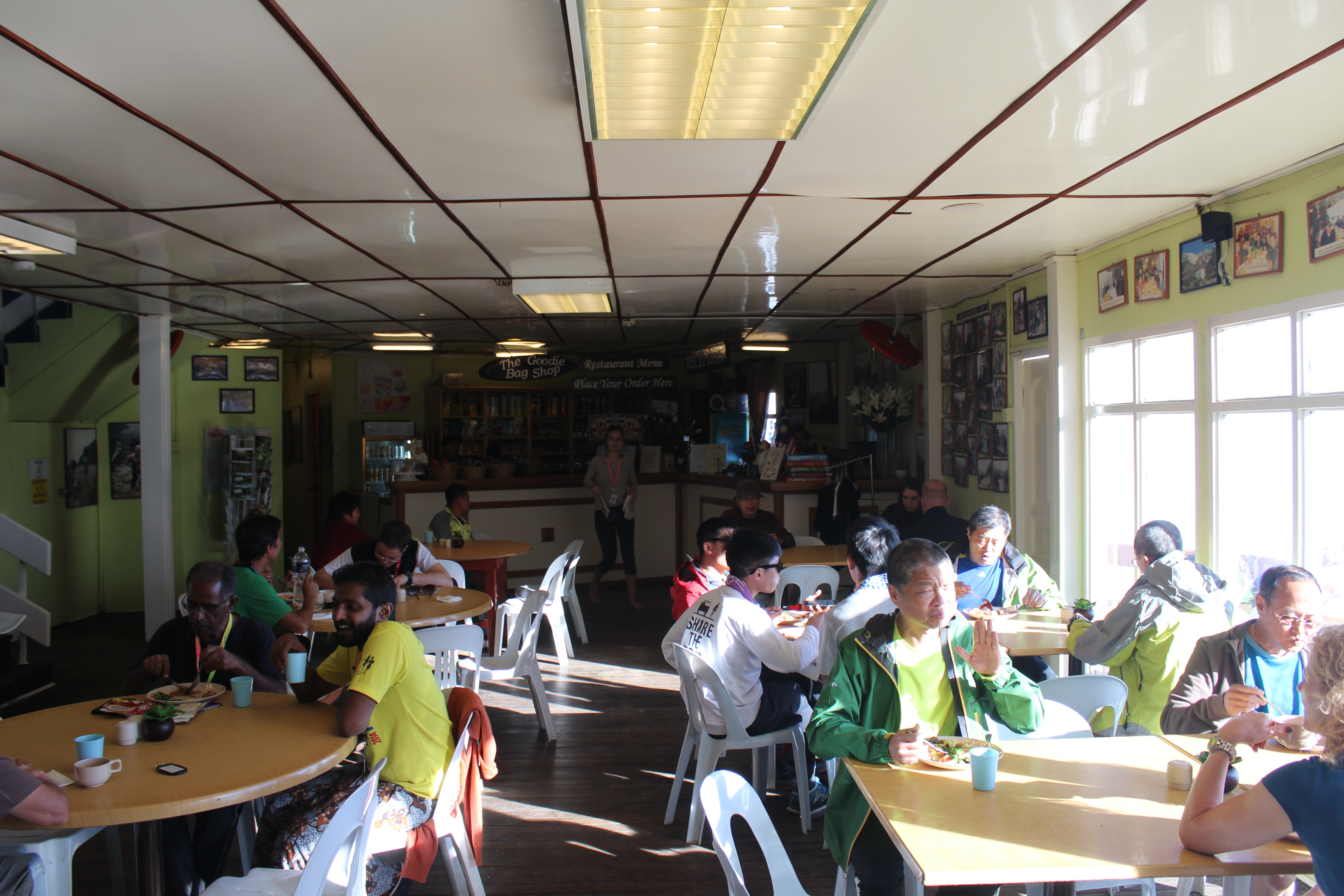
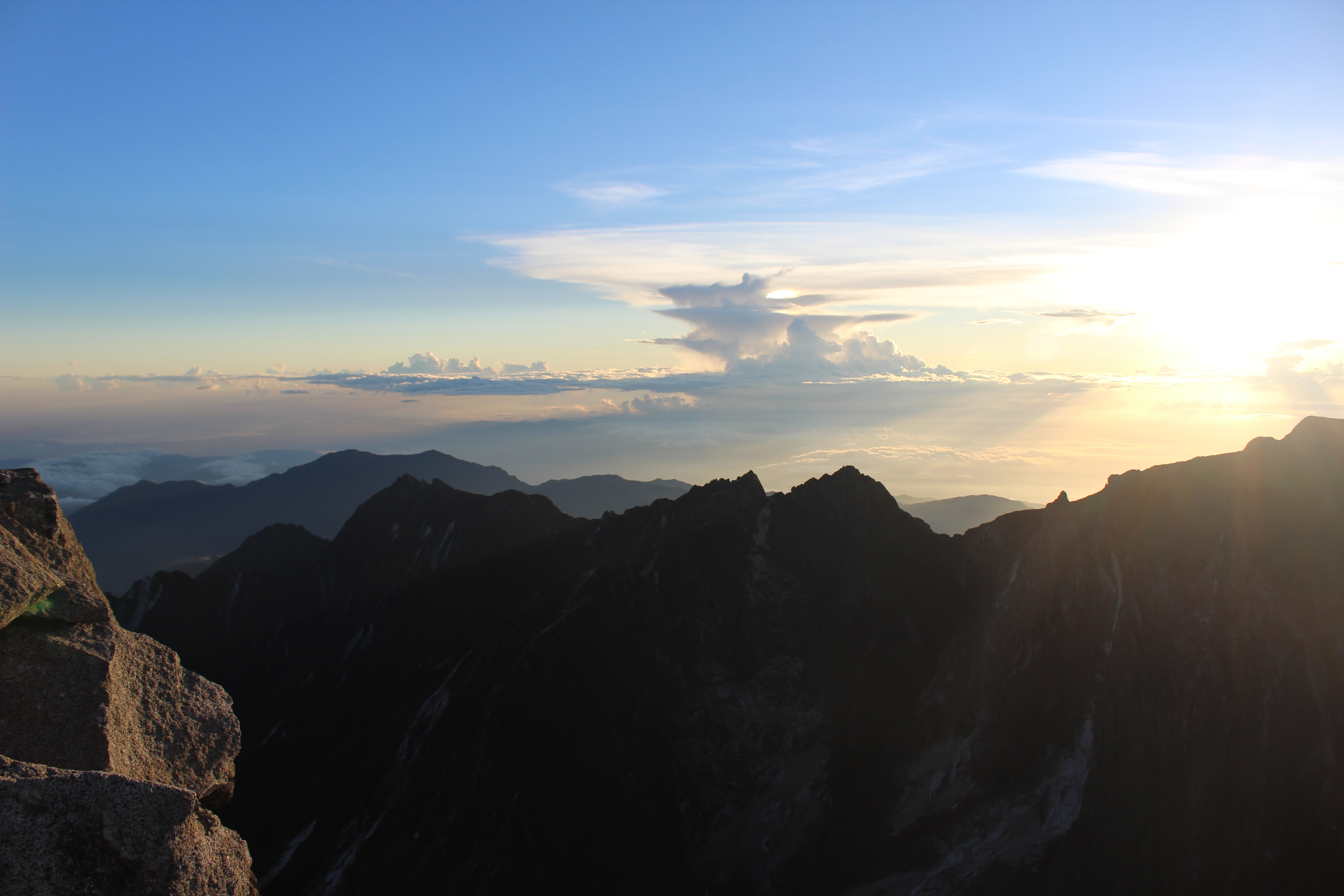
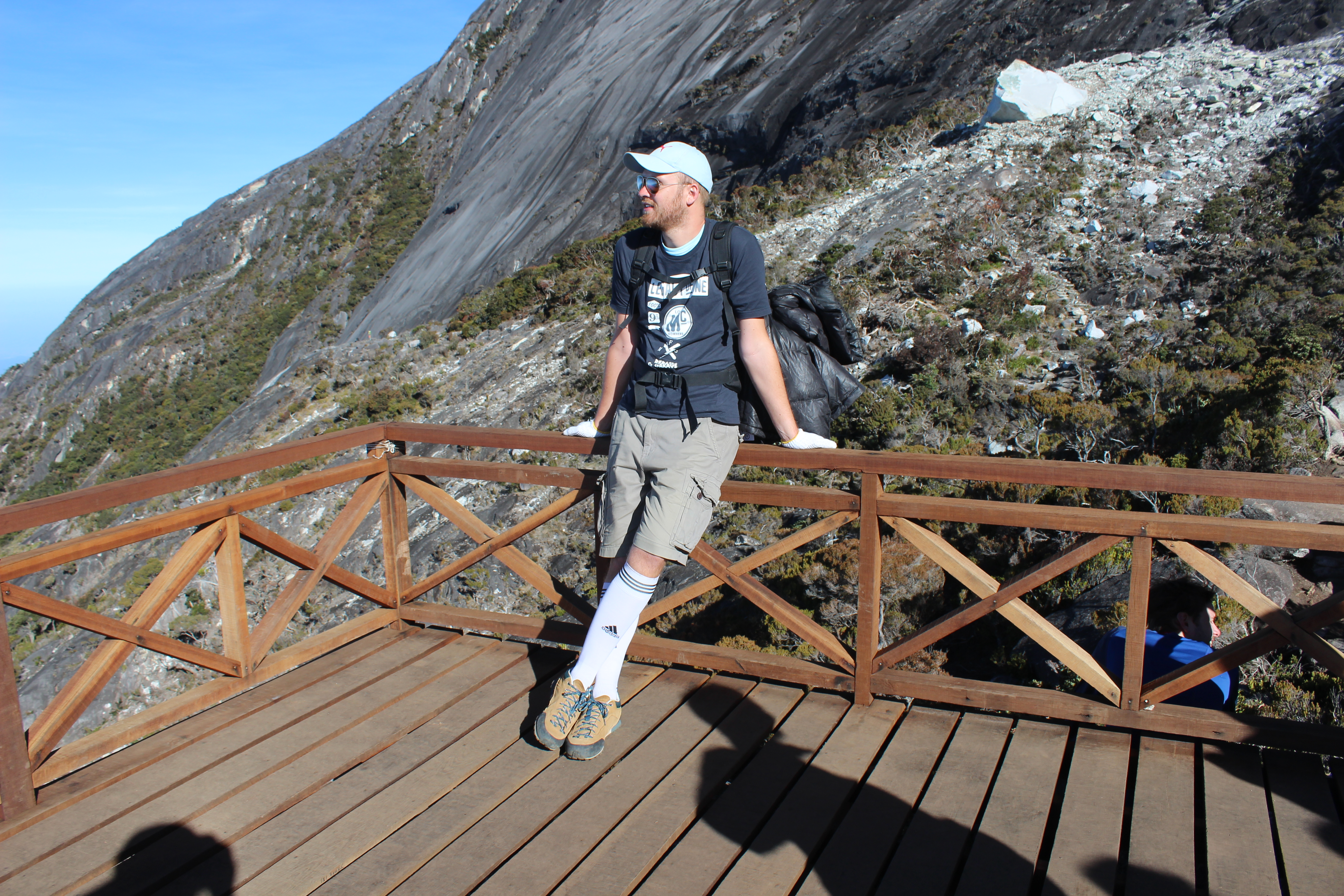
De laatste 1,5 km richting de lodge gaan vanuit de wolken naar net boven de wolken en dit is dan ook het moment dat de omgeving extra interessant begint te worden. Er groeien speciale planten en bomen in dit gebied, omdat ze vaak in de wolken zitten. Ook leven hier bijzondere dieren die hier goed vertoeven. Het uitzicht als je achterom keek werd ook steeds mooier, wat een belonend gevoel gaf. Uiteindelijk aangekomen bij de lodge rond 15:00. De lodge is een netjes verzorgde lodge, maar is bijzonder duur in vergelijking met andere lodges in het land. Maar de reden hiervoor is dat alle materialen, zoals hout, gasflessen, kabels, maar ook voedsel en drinken met de hand naar boven moeten worden gedragen. Na een overwinningsbiertje, genoten van het uitzicht en lekker gegeten van het buffet met spaghetti en noodles. Gekletst en ervaringen besproken en naar bed rond 20:00, want… De wekker stond om 2:30. ‘s Nachts.
Lookout backwards for a minute or two

Finally above the clouds
Reached our accommodation for the night
Food and relaxing with an amazing view
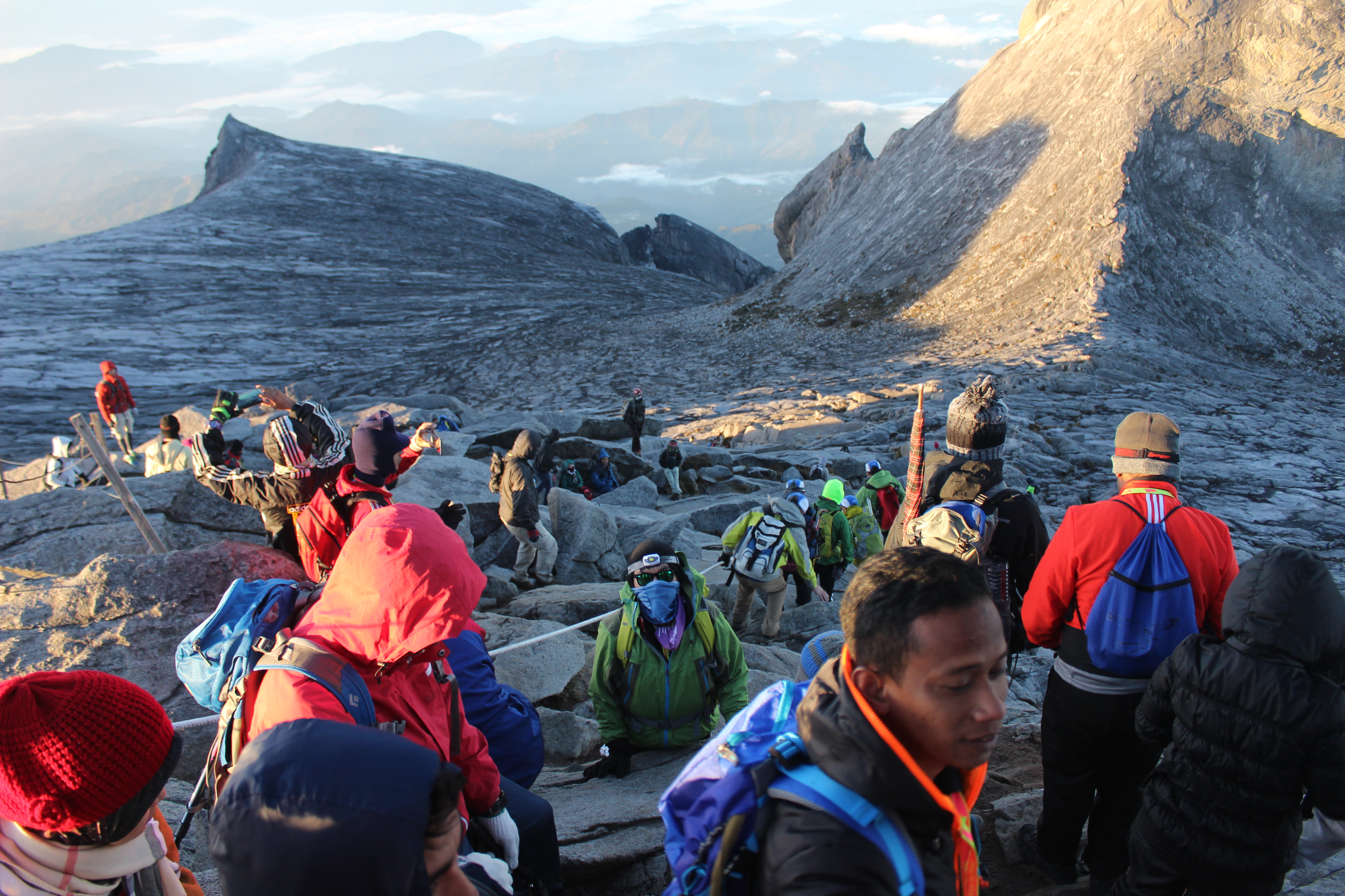
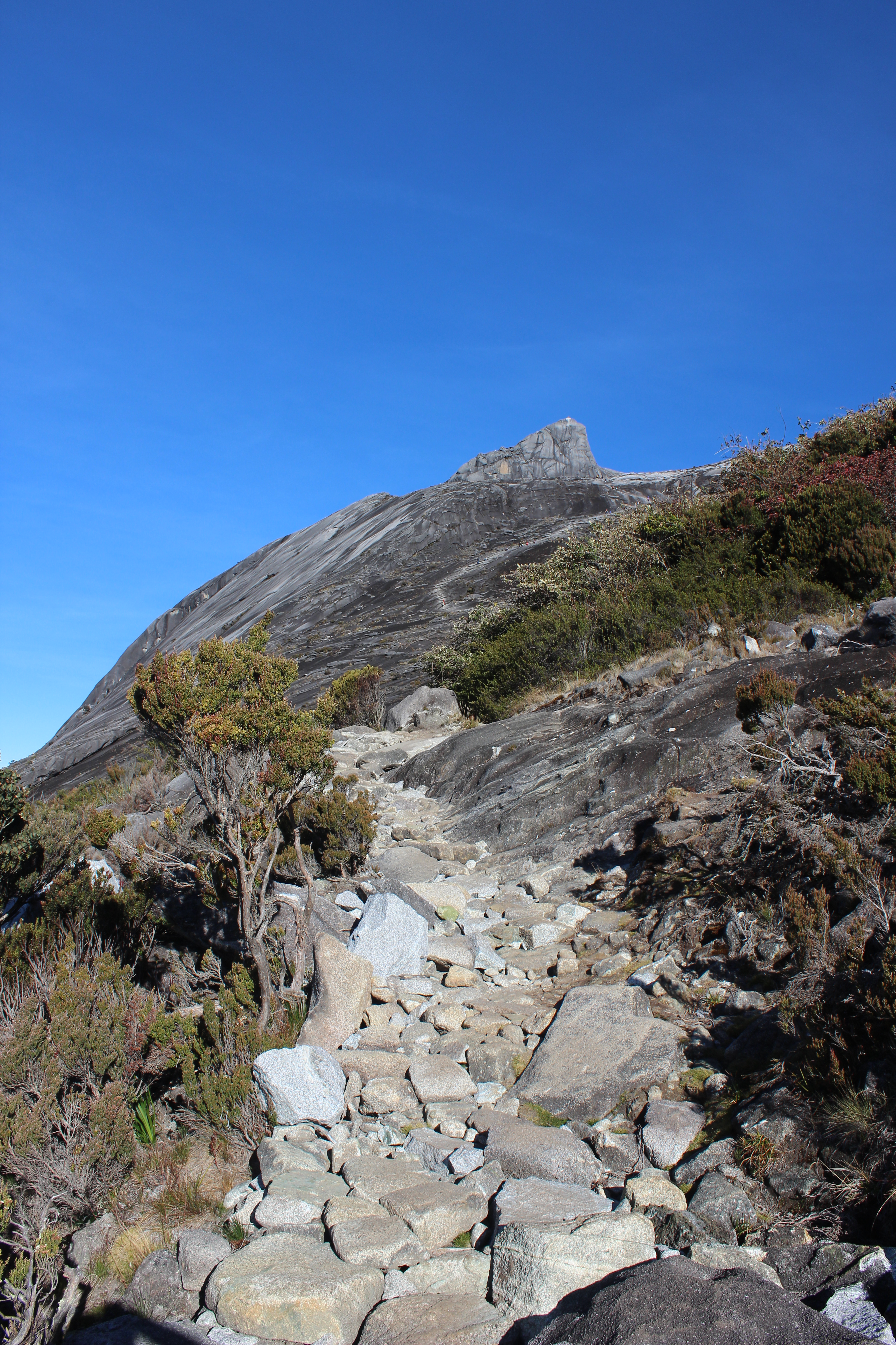
Het tweede deel van de beklimming werd vervolgd voor zonsopkomst, zodat deze vanaf de top van de berg kon worden ervaren. Rond 3:00 vertrok mijn groepje. Het eerste deel waren veen trappen, want dit was een nieuw stuk wat na de aardbeving van 2015 opnieuw was aangelegd. De kilometers gingen nu niet zo snel meer, maar zoals de locals zeggen: “pelan pelan”, oftewel slow but steady. Met basteps ging het laatste stuk omhoog over graniet en andere steensoorten, waarbij hier en daar een stuk met een touw geklommen kon worden. Niet super stijl, maar wel net ff handig. Het begon al te schemeren toen we bij het laatste stuk aankwamen. De boomgrens was gepasseerd en het werd iets minder stijl. We kwamen aan bij de pieken die vanaf beneden te zien zijn, maar de eigenlijke hoogste top ligt nog net iets verder. Het allerlaatste stuk, zo’n halve kilometer denk ik was nog iets vlakker, net voordat het laatste stuk naar het hoogste punt beklommen moest worden. Dit was zo’n 100-200 meter, en ook het eerste stuk waar je je handen voor moest gebruiken. Hier waren al meer mensen en het was om de beurt een foto maken met de opkomende zon op de piek. Het uitzicht vanaf hier was fenomenaal. Adembenemend mooi. Wat een overwinning en wat een prestatie! Al moesten we nog aan de terugreis beginnen… Tijd: 7:00.

Start of the sunrise almost at the top
Ice cold view almost at the summit
Waiting in line for a picture at the peak
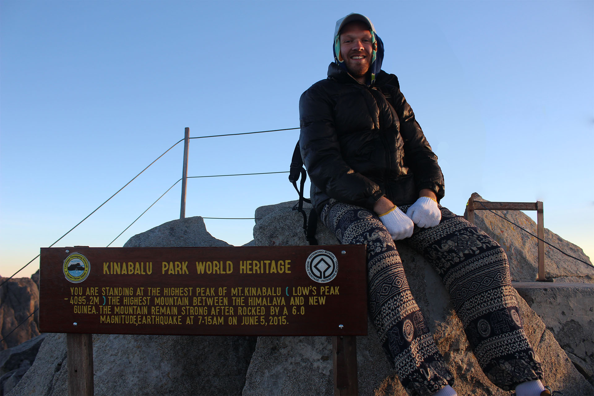
Made it to 4095 meters above sea level!
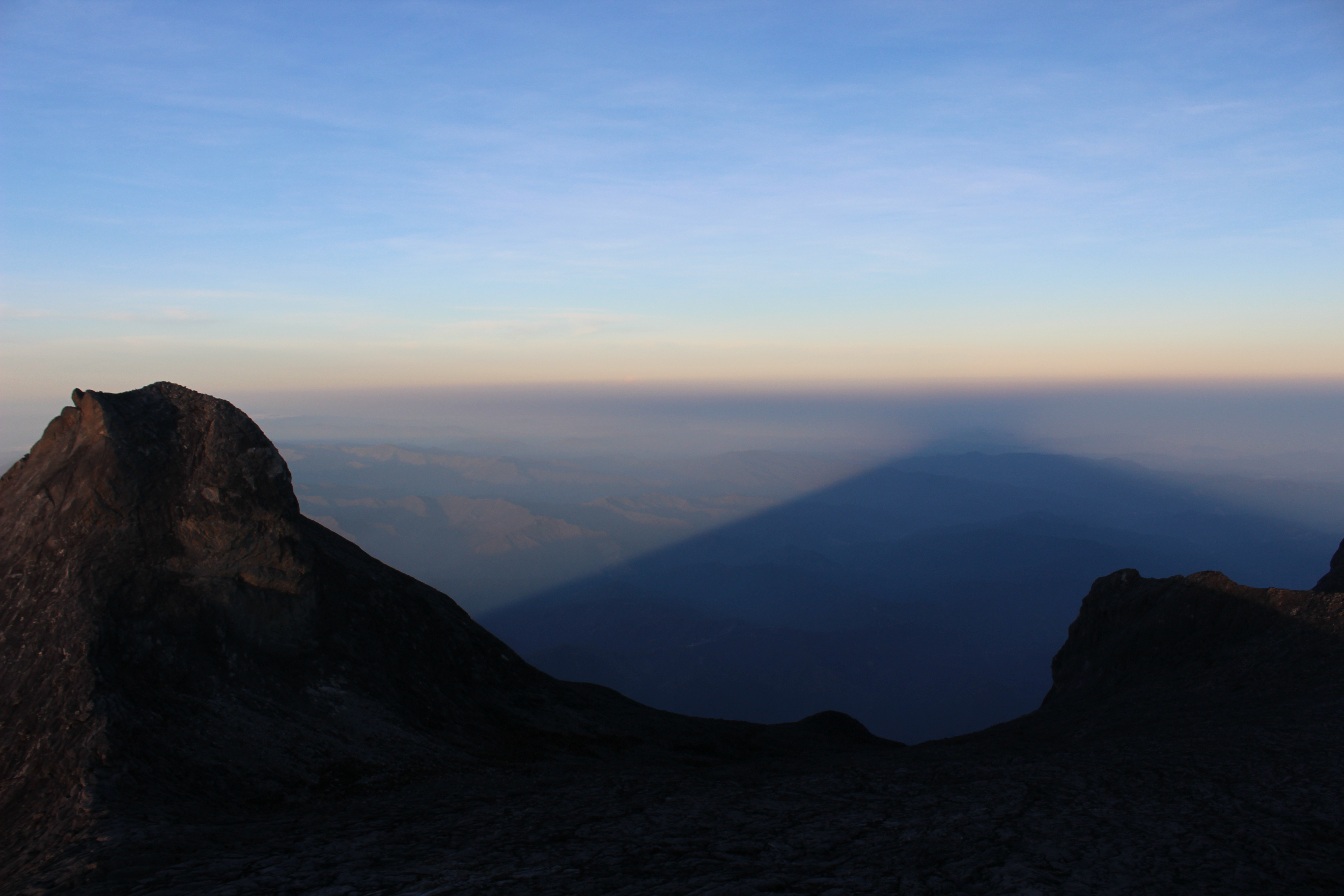
Shadow of the mountain
Sunrise above neighbouring mountains

Perfect visibility today
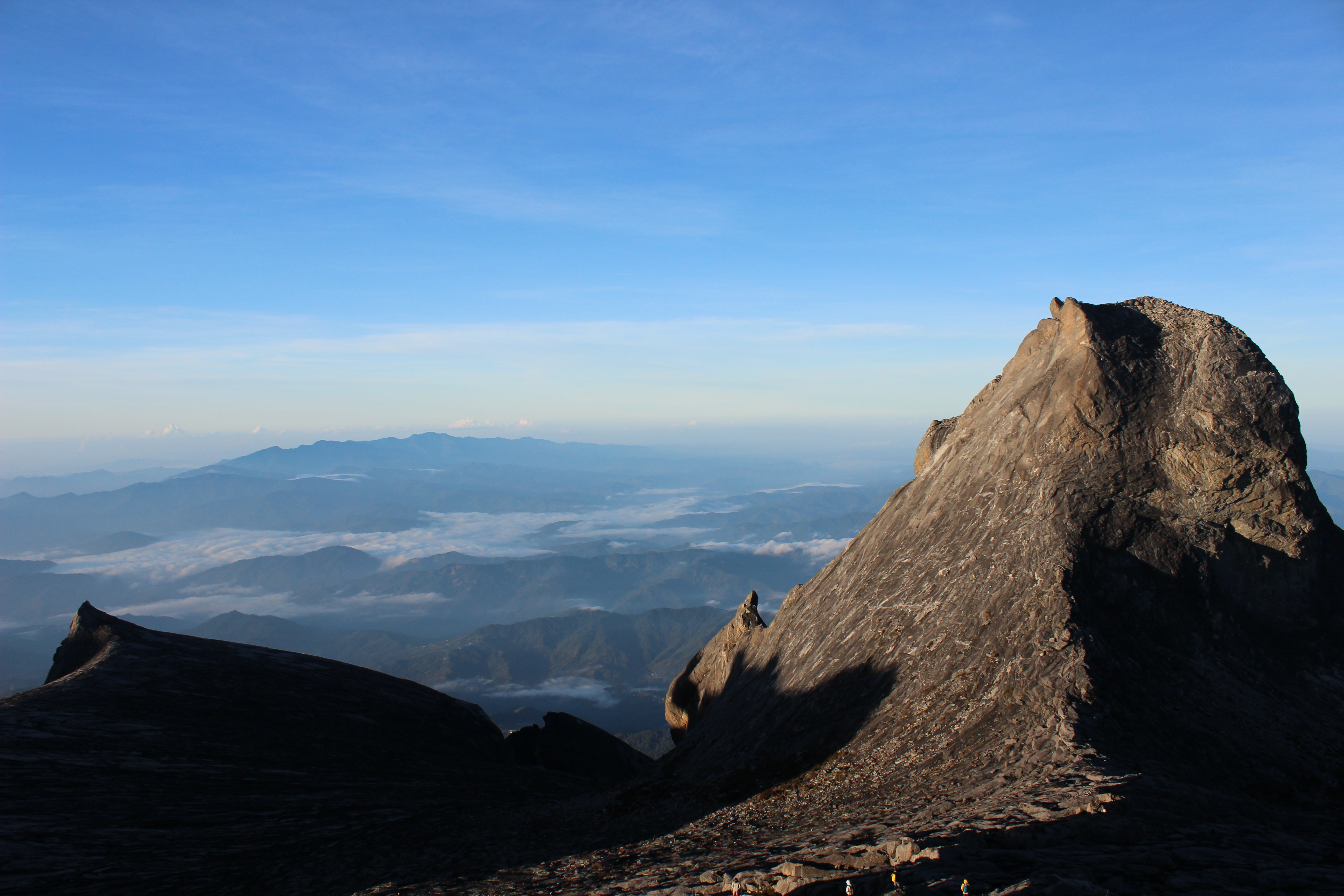
Gorilla Rock, next to the summit
Ik was gekleed in gekregen voetbalsokken, een geleende hippiebroek van een meisje, een geleend fleecevest van een man, een gehuurde winterjas, gekochte handschoenen, m’n korte broek, twee t-shirts, m’n pareo/sarong als muts/sjaal en m’n pet. Ik zag er uit als een clown. Maar deze kleding was absoluut nodig, want op de top was het ongeveer -1, te zien aan het dunne laagje ijs wat op de plasjes lag. Gelukkig was de zon ondertussen helemaal opgekomen, wat zorgde voor warmte en een mooi uitzicht naar beneden, want de wolken rond de berg verdwenen als sneeuw voor de zon.
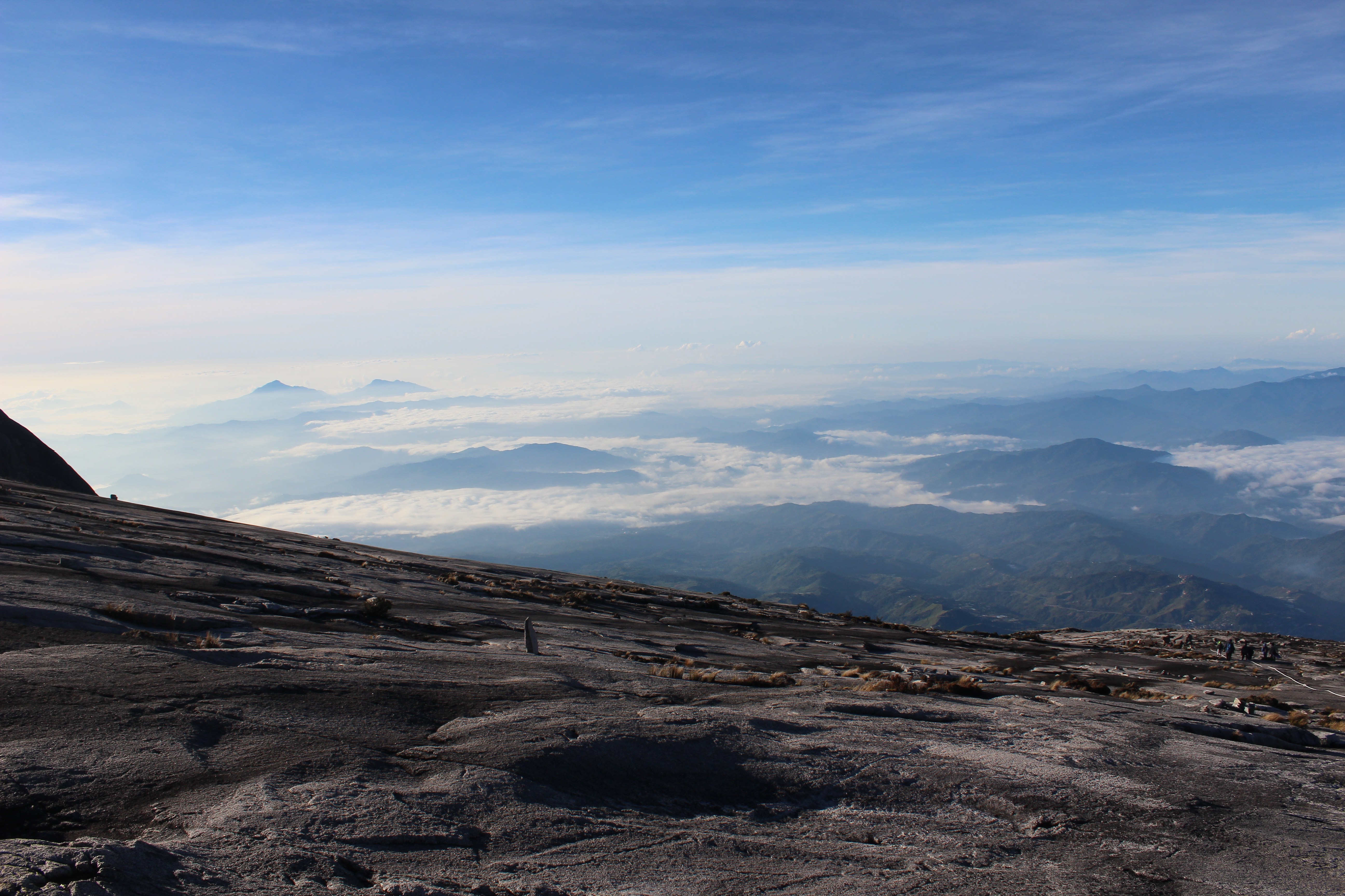
The more flat last bit from the top
Walking back down from the top
Green views and rough paths during daytime
Rough idea of most of the upper paths

Almost down again from still quite high
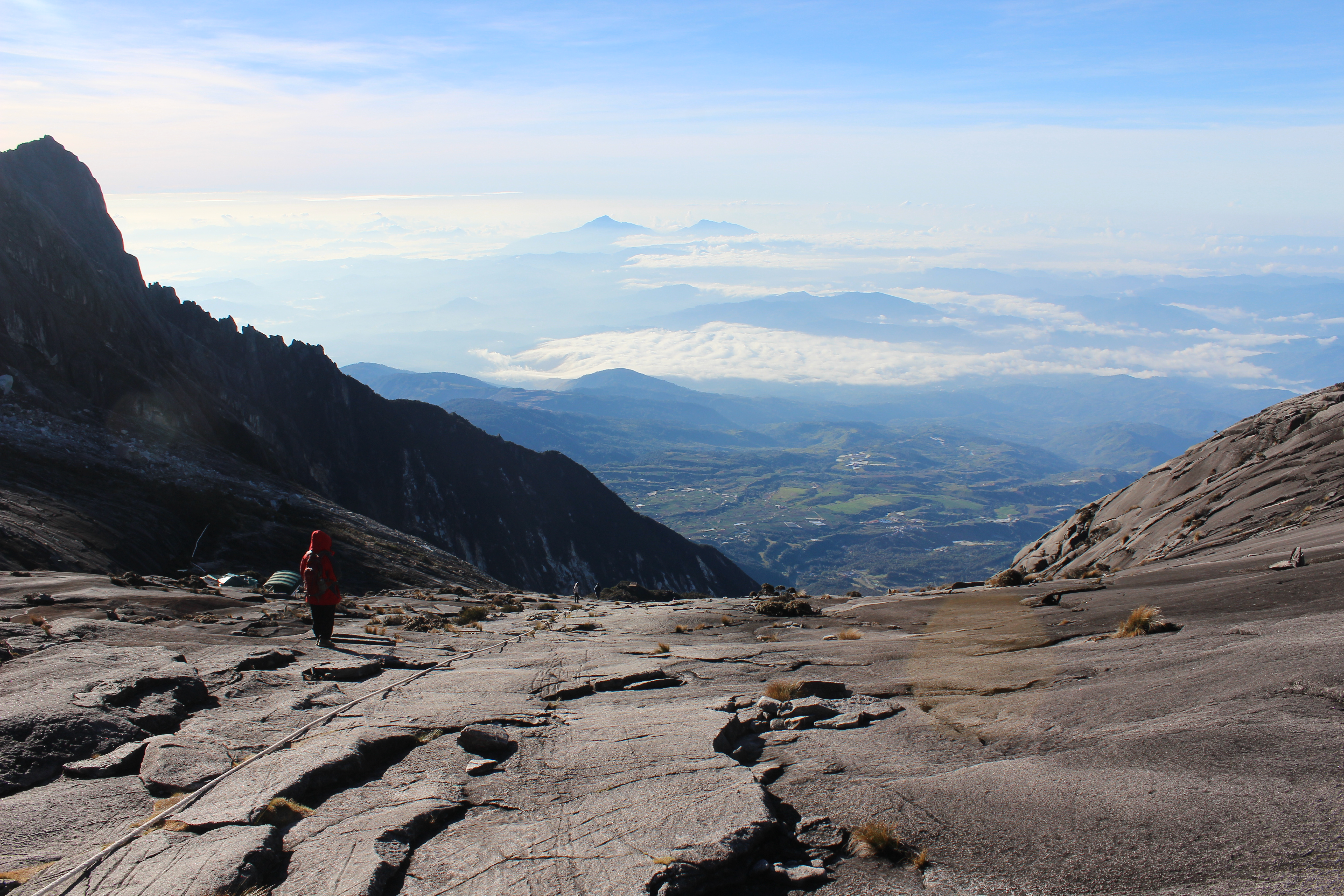
Het eerste stuk terug over het steen ging voorspoedig en zigzaggend achter de gids aan kwamen we weer bij de boomgrens. Kleding weer uit en verder naar beneden. Vanaf hier begon het pittig te worden. De druk op de benen bij de afdaling via stenen, boomwortels en trappen begonnen hun tol te eisen. Het werd steeds zwaarder in de buiten en bovenbenen en de druk op de knieën nam toe. Gelukkig aangekomen bij de lodge om 9:30, waar een tweede ontbijt ons te wachten stond. Een uurtje pauze. Leek een goed idee. Ik stond op om 10:30 en stortte bijna in elkaar; m’n benen voelden als elastieken. Even m’n moed verzameld en doorgezet en het ging wel weer. We vertrokken naar beneden. Vol goede moed. Nog 6km te gaan.
One of the last lookouts on the way down
Elke stap begon pijn te doen. De bordjes van de volgende 0.5 km bleven uit en bleven uit. Telkens bij het volgende bordje rekenen en concluderen dat het nog wel ff zou duren voordat ik beneden zou zijn. Uiteindelijk werd het zelfs zwaar om grotere “traptredes” in de route te nemen. Leunen op de zijkant van de trail bood uitkomst. Later een grote tak gevonden om op te steunen. Uiteindelijk werden het twee takken. Geen gezicht. Maar ik kwam er wel. Uiteindelijk in een halve trance het laatste stuk naar beneden heel langzaam afgelegd, maar, slow but steady. Pauzeren had niet veel nut, ook vrij weinig gedaan op weg naar beneden. Een paar keer bijna door m’n benen gezakt, vergezeld met de nodige kreten die je normaal alleen hoort tijdens een potje tennis. Maar ik heb het gedaan. Over Mount Kinabalu wordt vaak gezegd dat het de hoogste berg van Zuidoost-Azië is. Dat is ie net niet. Hij is wel de hoogste van Maleisië en de hoogste van de wijde omgeving. Met 4,096 meter hoog is ie de op 20-na hoogste berg van de wereld. Volgens Wikipedia makkelijk te beklimmen. Dit moet relatief worden gezien. Ik was helemaal kapot. Helemaal gebroken. Maar oh, wat was dat het waard. Een week herstellen? Voelt in ieder geval alsof je iets bereikt hebt.
ENGLISH VERSION ↑
After three months in Kuala Lumpur and a new exempt stamp in my passport, I wanted to go to see Borneo too, as it is a part of Malaysia. Because of the threat of pirates being at the east coast of Sabah, it appeared as a smart idea to fly to Kota Kinabalu, Sabah, and check out to what extent the locals were saying how safe visiting the islands off the coast to the east. Kota Kinabalu is a city on the west coast of Sabah and was the starting point of the trip through Borneo. The Chilli Vanilla Cafe was rated high on TripAdvisor and I’ve spend some of my time there working while being served great food, good coffee and decent WiFi. After KK, the journey continued to Kundasang, a village in the center of Sabah, near the foot of Mount Kinabalu.
There I stayed in the D’Villa Lodge with a nice view of the valley and good WiFi. I worked for a few days, but the more people I spoke to, the more recommendations I got to climb the mountain. Although all my warm clothes were still in Kuala Lumpur and I only brought shorts, some T-shirts and my walking shoes. A retired mountain guide named Hock told me that this is the best chance of climbing a mountain anywhere in the world and he explained me how nice it is up there and that I’m already at the foot of the mountain. There is no reason not to climb it. There was no climbing equipment needed, only some basic hiking and a healthy portion of persistence were required. That ended up being true, only after realising it was the most heavy hike I’ve ever done.
Making a reservation via phone is not possible. Although they are able to tell you how many places there are left, if any. Sometimes there are places left on the (mandatory) lodge on the mountain, which they are happy to sell last minute. An alternative is you wait for cancellation of locals, because the Malaysians get the whole package for roughly half the price. The only thing is, you can call every hour to be informed or go there on the morning itself, because cancellations can happen until 10.30am.
We met up in the morning at the entrance of the Kinabalu Park, at the Information Centre. From here, we were transported to the gate, which marks the start of the trail. Time: 10.30am. Every half a kilometer there is a sign which reads the distance, which can work positively as well as in a negative way. Later you’ll understand why. It is advises to take it slow and walk 1 km every 1 hour, but I was in a group together with two sporty ladies, so we did the first 4km in 1.5 hours. From there, it became harder, because the muscles already started to be used to quite some extent. The lodge is at 6 km, so the signs from that moment are not that likable anymore. Time of the break at 4 km: 12.00pm.
The last 1.5 km to the lodge are going to lead up through and above the clouds. This is also the moment the scenery starts to get more interesting. Special flora and fauna can be found here, as the clouds around this area give a special living environment. Looking back down starts to get interesting here too, which gave a rewarding feeling. Eventually ended up at the lodge at 6 km distance around 15.00pm. The lodge was proper, clean and the food was good, pasta and noodles for early dinner. The lodge is rather expensive, but knowing that every piece of wood and cable and food and drink needs to be carried up the mountain hand, it is understandable. After having a victory beer and some chatting and sharing of experiences, I went to bed at 8.00pm… Because the alarm clock was set at 2.30am. At night.
The second part of the climb took place before sunset, as you would then be able to watch it from the top of the mountain – the summit. My group departed at 3.00am. The first part were stairs, which was newly built after the earthquake. The pieces of rock that fell from the mountain are still clearly visible in daylight. The pace was down to ba steps, so as the locals say “pelan pelan”; slow but steady. The last piece of the track was covered with granite and other specimen of rock, where at some places a rope was place for your convenience. Not that steep, but it gave just this extra stability. The track became a little more flat-ish when near the summit. The actual peak lies behind some other peaks, which are slightly less high. The peak itself is steep and goes up another 100-200 meters. This is the first place where using your hands was necessary. At this point, more people were climbing to the top and you could say it even was a little crowded at the very top. The sun already started to rise, so the view from the peak was absolutely breathtakingly beautiful. Phenomenal. Incredible. What a feat of strength. Nevertheless, there was still the descending part to come… Time: 7.00am.
I was wearing football socks which were given to me, borrowed hippie pants from a girl, borrowed fleece vest from a guy, rented winter jacket, bought gloves, my sarong/pareo around my head as a hat/scarf and my baseball cap, shorts and two T-shirts – I looked like a clown. It was rather nippy at the top, because of the absence of trees and the wind blowing, it felt freezing. I think it actually was, too, regarding the thin layer of ice on top of some of the puddles of water around there. This amount of clothing was an absolute necessity. Fortunately, the sun did provide heat and while zig-zagging down, layers of clothing could be removed. Also, the clouds went away, which provided a beautiful view of the valley below.
The first part descending went smoothly over the granite rocks and we came back to the tree line. From there, things started to get turn sour, literally speaking. The pressure on the legs increased and the pressure on the calves and knees were starting to speak for themselves. Fortunately, we arrived at the lodge at 9.30am again to have a break of one hour and a second breakfast. When I stood up at 10.30am, I almost collapsed. My legs had turned into rubber and I had trouble standing. My thoughts were to just man up and that it would become less when walking out the door. It did became less. For a short while. I gathered some courage and started the 6 km descending.
Every step started to hurt. The distance signs were not appearing that regularly anymore and I calculated that it would take quite some time to come down the complete mountain. Eventually, even the bigger “steps” became almost impossible to overcome. Leaning on the side of the track, finding support in roots and rocks brought me down one step at a time. I found a big branch to support me as a means of walking stick. Eventually I got two of them. I looked like a grandpa. But I managed. Being half in a trance, I was descending slow but steady. Taking a break wouldn’t help to a great deal, so we just continued. Slow but steady. After almost collapsing multiple times, accompanied with the moans you only hear at a proper game of tennis, I did it. I managed. They sometimes say erroneous that Mount Kinabalu is the highest mountain of South East Asia. It is almost. At 4.096 meters high, it is the 20th highest mountain in the world. According to Wikipedia, it should be an easy climb. This should be read in comparison to climbing other mountains I guess. I was shattered. Utterly broken and completely exhausted. But it was worth it. A week recovering? At least it feels like having accomplished something.
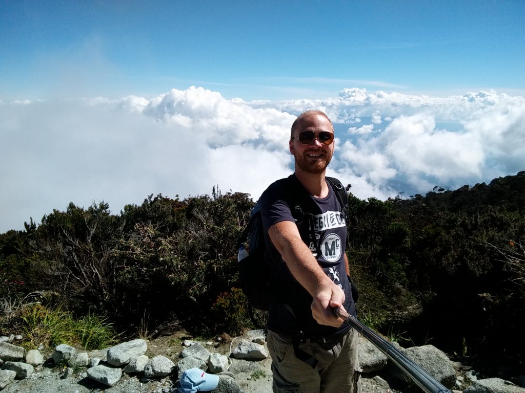
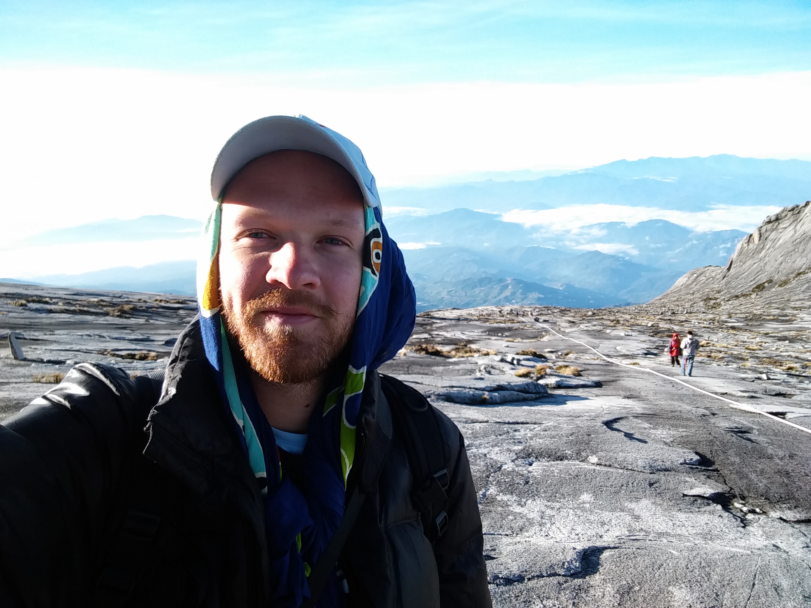
Selfie above the clouds!